
- Startseite >
- Flüsse >
- Wasserstand >
- Untere Donau >
- Chamerau >
- Jahresgrafik

Jahresgrafik Chamerau / Regen
Wasserstand vom 19.06.2021 bis zum 18.06.2022
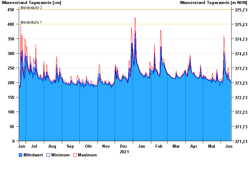
- Meldestufe 1 400 cm
- Meldestufe 2 450 cm
- Meldestufe 3 500 cm
- Meldestufe 4 600 cm
- Hochwassergefahrenfläche HQ100 610 cm
| Datum | Mittelwert [cm] | Maximum [cm] | Minimum [cm] |
|---|---|---|---|
| 18.06.2022 | 205 | 211 | 200 |
| 17.06.2022 | 208 | 208 | 205 |
| 16.06.2022 | 207 | 209 | 205 |
| 15.06.2022 | 211 | 215 | 209 |
| 14.06.2022 | 223 | 244 | 213 |
| 13.06.2022 | 234 | 252 | 209 |
| 12.06.2022 | 214 | 217 | 209 |
© Bayerisches Landesamt für Umwelt 2024