
- Startseite >
- Flüsse >
- Wasserstand >
- Untere Donau >
- Chamerau >
- Jahresgrafik

Jahresgrafik Chamerau / Regen
Wasserstand vom 01.01.2024 bis zum 19.04.2024
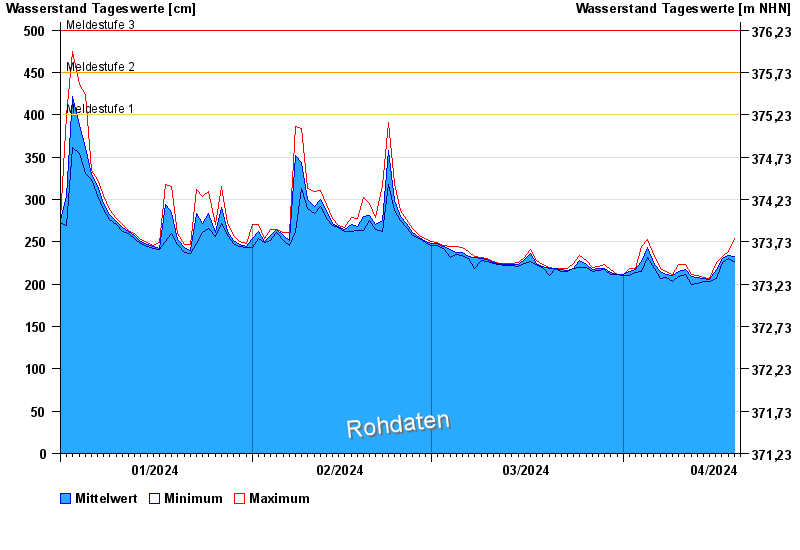
- Meldestufe 1 400 cm
- Meldestufe 2 450 cm
- Meldestufe 3 500 cm
- Meldestufe 4 600 cm
- Hochwassergefahrenfläche HQ100 610 cm
| Datum | Mittelwert [cm] | Maximum [cm] | Minimum [cm] |
|---|---|---|---|
| 19.04.2024 | 231 | 237 | 227 |
| 18.04.2024 | 234 | 239 | 230 |
| 17.04.2024 | 230 | 233 | 226 |
| 16.04.2024 | 217 | 226 | 207 |
| 15.04.2024 | 206 | 207 | 203 |
| 14.04.2024 | 207 | 208 | 203 |
| 13.04.2024 | 208 | 210 | 201 |
© Bayerisches Landesamt für Umwelt 2024