
- Startseite >
- Flüsse >
- Wasserstand >
- Untere Donau >
- Arzberg >
- Jahresgrafik

Jahresgrafik Arzberg / Röslau
Wasserstand vom 01.01.2024 bis zum 19.04.2024
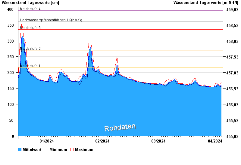
- Meldestufe 1 215 cm
- Meldestufe 2 270 cm
- Meldestufe 3 335 cm
- Meldestufe 4 395 cm
- Hochwassergefahrenfläche HQhäufig 360 cm
| Datum | Mittelwert [cm] | Maximum [cm] | Minimum [cm] |
|---|---|---|---|
| 19.04.2024 | 157 | 162 | 156 |
| 18.04.2024 | 158 | 159 | 157 |
| 17.04.2024 | 163 | 166 | 159 |
| 16.04.2024 | 158 | 166 | 155 |
| 15.04.2024 | 155 | 155 | 154 |
| 14.04.2024 | 155 | 155 | 154 |
| 13.04.2024 | 155 | 156 | 154 |
© Bayerisches Landesamt für Umwelt 2024