
- Startseite >
- Flüsse >
- Wasserstand >
- Untere Donau >
- Aham >
- Jahresgrafik

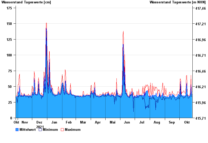
Jahresgrafik Aham / Vils
Wasserstand vom 28.10.2021 bis zum 27.10.2022
- 03.06.2013 Wasserstand: 203 cm
- 04.08.1991 Wasserstand: 197 cm
- 20.02.1999 Wasserstand: 187 cm
- 04.06.2010 Wasserstand: 186 cm
- 19.01.1974 Wasserstand: 182 cm
| Datum | Mittelwert [cm] | Maximum [cm] | Minimum [cm] |
|---|---|---|---|
| 27.10.2022 | 37 | 42 | 34 |
| 26.10.2022 | 39 | 43 | 34 |
| 25.10.2022 | 53 | 68 | 43 |
| 24.10.2022 | 40 | 55 | 35 |
| 23.10.2022 | 36 | 40 | 34 |
| 22.10.2022 | 35 | 37 | 34 |
| 21.10.2022 | 34 | 35 | 32 |
© Bayerisches Landesamt für Umwelt 2024