
- Startseite >
- Flüsse >
- Wasserstand >
- Unterer Main >
- Schweinfurt Neuer Hafen >
- Monatsgrafik

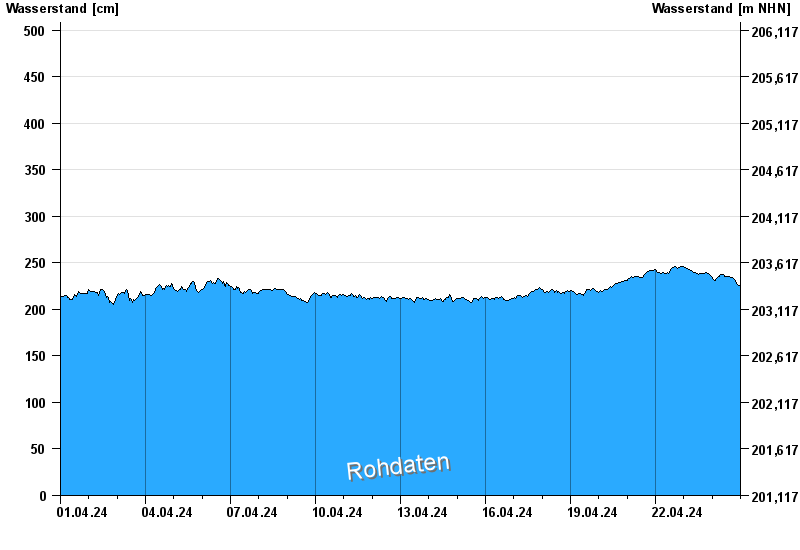
Monatsgrafik Schweinfurt Neuer Hafen / Main
Wasserstand vom 01.04.2024 bis zum 24.04.2024
- 24.02.1970 Wasserstand: 697 cm
- 05.01.2003 Wasserstand: 672 cm
- 16.01.2011 Wasserstand: 654 cm
- 07.01.1982 Wasserstand: 651 cm
- 28.01.1995 Wasserstand: 645 cm
| Datum | Wasserstand [cm] |
|---|---|
| 24.04.2024 07:30 | 238 |
| 24.04.2024 07:15 | 238 |
| 24.04.2024 07:00 | 237 |
| 24.04.2024 06:45 | 237 |
| 24.04.2024 06:30 | 236 |
| 24.04.2024 06:15 | 236 |
| 24.04.2024 06:00 | 236 |
© Bayerisches Landesamt für Umwelt 2024