
- Startseite >
- Flüsse >
- Wasserstand >
- Unterer Main >
- Astheim >
- Jahresgrafik

Jahresgrafik Astheim / Main
Wasserstand vom 01.01.2022 bis zum 31.12.2022
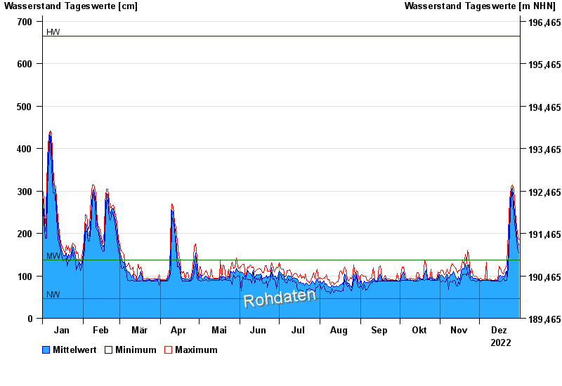
| Datum | Mittelwert [cm] | Maximum [cm] | Minimum [cm] |
|---|---|---|---|
| 31.12.2022 | 173 | 186 | 154 |
| 30.12.2022 | 183 | 201 | 166 |
| 29.12.2022 | 213 | 232 | 198 |
| 28.12.2022 | 233 | 253 | 210 |
| 27.12.2022 | 267 | 304 | 239 |
| 26.12.2022 | 308 | 315 | 304 |
| 25.12.2022 | 299 | 308 | 280 |
© Bayerisches Landesamt für Umwelt 2024