
- Startseite >
- Flüsse >
- Wasserstand >
- Unterer Main >
- Astheim >
- Jahresgrafik

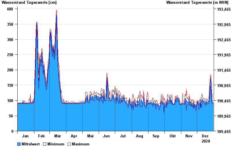
Jahresgrafik Astheim / Main
Wasserstand vom 01.01.2020 bis zum 31.12.2020
- 16.01.2011 Wasserstand: 665 cm
- 05.01.2003 Wasserstand: 663 cm
- 25.02.1970 Wasserstand: 627 cm
- 08.01.1982 Wasserstand: 624 cm
- 28.01.1995 Wasserstand: 623 cm
| Datum | Mittelwert [cm] | Maximum [cm] | Minimum [cm] |
|---|---|---|---|
| 31.12.2020 | 90 | 90 | 90 |
| 30.12.2020 | 90 | 91 | 89 |
| 29.12.2020 | 97 | 107 | 89 |
| 28.12.2020 | 115 | 141 | 90 |
| 27.12.2020 | 142 | 168 | 107 |
| 26.12.2020 | 175 | 186 | 147 |
| 25.12.2020 | 156 | 165 | 144 |
© Bayerisches Landesamt für Umwelt 2024