
- Startseite >
- Flüsse >
- Wasserstand >
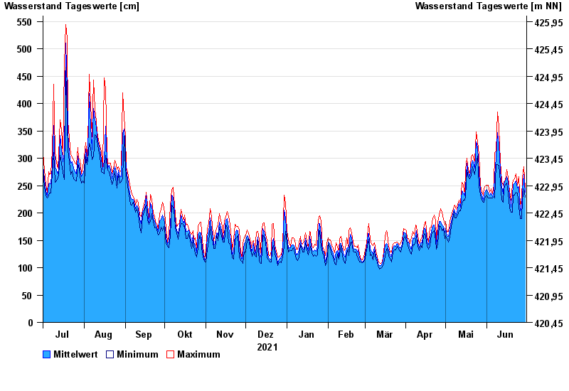
- Isar >
- Wasserburg >
- Jahresgrafik

Jahresgrafik Wasserburg / Inn
Wasserstand vom 01.07.2021 bis zum 30.06.2022
- 23.08.2005 Wasserstand: 719 cm
- 07.08.1985 Wasserstand: 670 cm
- 21.05.1999 Wasserstand: 638 cm
- 02.06.2013 Wasserstand: 630 cm
- 20.07.1981 Wasserstand: 615 cm
| Datum | Mittelwert [cm] | Maximum [cm] | Minimum [cm] |
|---|---|---|---|
| 30.06.2022 | 238 | 246 | 229 |
| 29.06.2022 | 270 | 285 | 244 |
| 28.06.2022 | 243 | 265 | 224 |
| 27.06.2022 | 210 | 224 | 190 |
| 26.06.2022 | 204 | 213 | 190 |
| 25.06.2022 | 248 | 267 | 210 |
| 24.06.2022 | 245 | 251 | 237 |
© Bayerisches Landesamt für Umwelt 2024