
- Startseite >
- Flüsse >
- Wasserstand >
- Isar >
- Rosenheim u.d. Mangfallmündung >
- Monatsgrafik

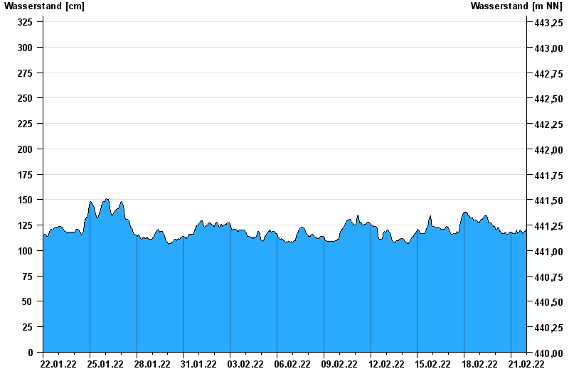
Monatsgrafik Rosenheim u.d. Mangfallmündung / Inn
Wasserstand vom 22.01.2022 bis zum 21.02.2022
- 23.08.2005 Wasserstand: 511 cm
- 07.08.1985 Wasserstand: 483 cm
- 02.06.2013 Wasserstand: 468 cm
- 21.05.1999 Wasserstand: 451 cm
- 20.07.1981 Wasserstand: 441 cm
| Datum | Wasserstand [cm] |
|---|---|
| 21.02.2022 23:45 | 120 |
| 21.02.2022 23:30 | 120 |
| 21.02.2022 23:15 | 120 |
| 21.02.2022 23:00 | 120 |
| 21.02.2022 22:45 | 120 |
| 21.02.2022 22:30 | 120 |
| 21.02.2022 22:15 | 119 |
© Bayerisches Landesamt für Umwelt 2024