
- Startseite >
- Flüsse >
- Wasserstand >
- Isar >
- Eschelbach >
- Jahresgrafik

Jahresgrafik Eschelbach / Inn
Wasserstand vom 28.07.2018 bis zum 27.07.2019
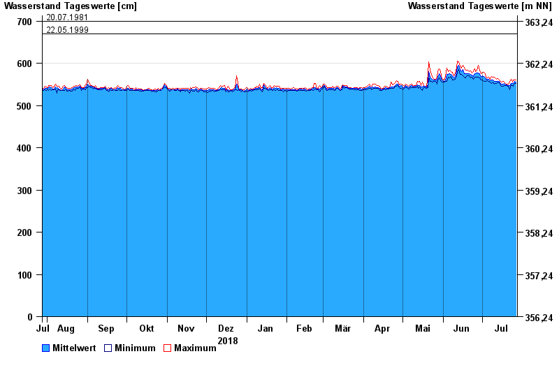
- 07.08.1985 Wasserstand: 709 cm
- 24.08.2005 Wasserstand: 704 cm
- 03.06.2013 Wasserstand: 702 cm
- 20.07.1981 Wasserstand: 700 cm
- 22.05.1999 Wasserstand: 669 cm
| Datum | Mittelwert [cm] | Maximum [cm] | Minimum [cm] |
|---|---|---|---|
| 27.07.2019 | 556 | 560 | 553 |
| 26.07.2019 | 557 | 561 | 553 |
| 25.07.2019 | 552 | 560 | 545 |
| 24.07.2019 | 552 | 556 | 548 |
| 23.07.2019 | 553 | 563 | 549 |
| 22.07.2019 | 547 | 556 | 537 |
| 21.07.2019 | 548 | 550 | 546 |
© Bayerisches Landesamt für Umwelt 2024