
- Startseite >
- Flüsse >
- Wasserstand >
- Isar >
- Bad Trißl >
- Jahresgrafik

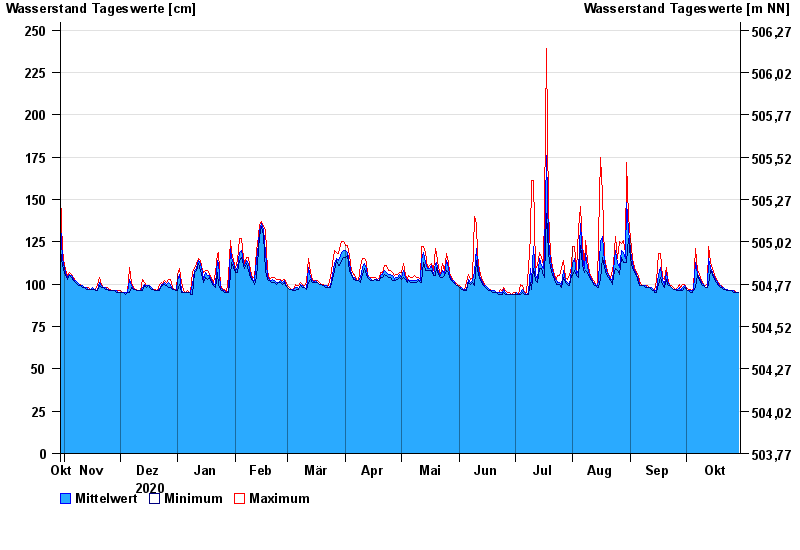
Jahresgrafik Bad Trißl / Auerbach
Wasserstand vom 30.10.2020 bis zum 29.10.2021
- 20.02.1999 Wasserstand: 337 cm
- 30.01.2000 Wasserstand: 298 cm
- 21.05.1999 Wasserstand: 279 cm
- 22.12.1991 Wasserstand: 276 cm
- 12.08.2002 Wasserstand: 264 cm
| Datum | Mittelwert [cm] | Maximum [cm] | Minimum [cm] |
|---|---|---|---|
| 29.10.2021 | 95 | 95 | 95 |
| 28.10.2021 | 95 | 95 | 95 |
| 27.10.2021 | 95 | 96 | 95 |
| 26.10.2021 | 96 | 96 | 95 |
| 25.10.2021 | 96 | 96 | 96 |
| 24.10.2021 | 96 | 96 | 96 |
| 23.10.2021 | 97 | 97 | 96 |
© Bayerisches Landesamt für Umwelt 2024