
- Startseite >
- Flüsse >
- Wasserstand >
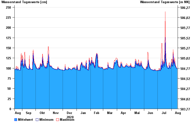
- Isar >
- Bad Trißl >
- Jahresgrafik

Jahresgrafik Bad Trißl / Auerbach
Wasserstand vom 15.08.2020 bis zum 14.08.2021
- 20.02.1999 Wasserstand: 337 cm
- 30.01.2000 Wasserstand: 298 cm
- 21.05.1999 Wasserstand: 279 cm
- 22.12.1991 Wasserstand: 276 cm
- 12.08.2002 Wasserstand: 264 cm
| Datum | Mittelwert [cm] | Maximum [cm] | Minimum [cm] |
|---|---|---|---|
| 14.08.2021 | 99 | 99 | 98 |
| 13.08.2021 | 100 | 100 | 99 |
| 12.08.2021 | 101 | 102 | 100 |
| 11.08.2021 | 103 | 104 | 102 |
| 10.08.2021 | 105 | 107 | 104 |
| 09.08.2021 | 110 | 114 | 107 |
| 08.08.2021 | 118 | 126 | 108 |
© Bayerisches Landesamt für Umwelt 2024