
- Startseite >
- Flüsse >
- Wasserstand >
- Isar >
- Achsheim >
- Monatsgrafik

Monatsgrafik Achsheim / Schmutter
Wasserstand vom 01.04.2024 bis zum 19.04.2024
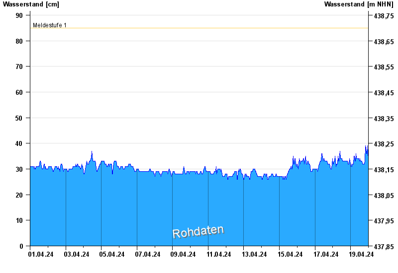
- Meldestufe 1 85 cm
- Meldestufe 2 110 cm
- Meldestufe 3 120 cm
- Meldestufe 4 130 cm
- Hochwassergefahrenfläche HQ100 160 cm
| Datum | Wasserstand [cm] |
|---|---|
| 19.04.2024 17:00 | 32 |
| 19.04.2024 16:45 | 32 |
| 19.04.2024 16:30 | 32 |
| 19.04.2024 16:15 | 32 |
| 19.04.2024 16:00 | 32 |
| 19.04.2024 15:45 | 32 |
| 19.04.2024 15:30 | 33 |
© Bayerisches Landesamt für Umwelt 2024