
- Startseite >
- Flüsse >
- Wasserstand >
- Inn >
- Weg >
- Jahresgrafik

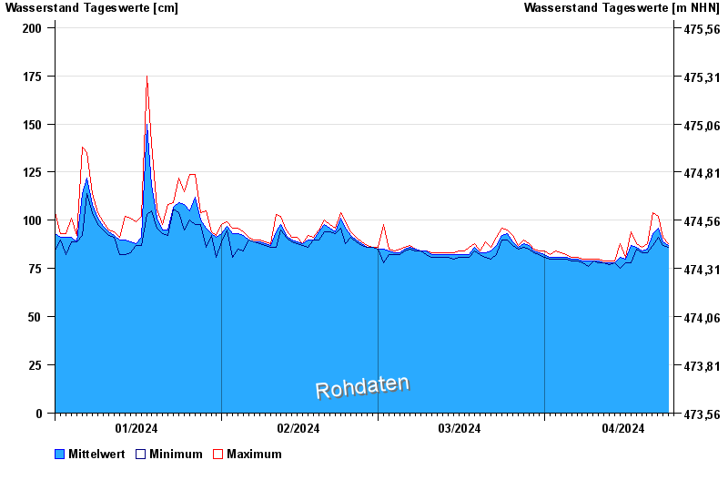
Jahresgrafik Weg / Isen
Wasserstand vom 01.01.2024 bis zum 24.04.2024
- 22.06.1975 Wasserstand: 375 cm
- 22.08.1977 Wasserstand: 355 cm
- 01.08.1991 Wasserstand: 332 cm
- 04.08.1973 Wasserstand: 332 cm
- 15.02.1990 Wasserstand: 330 cm
| Datum | Mittelwert [cm] | Maximum [cm] | Minimum [cm] |
|---|---|---|---|
| 24.04.2024 | 87 | 88 | 86 |
| 23.04.2024 | 89 | 91 | 87 |
| 22.04.2024 | 96 | 102 | 91 |
| 21.04.2024 | 93 | 104 | 87 |
| 20.04.2024 | 85 | 88 | 83 |
| 19.04.2024 | 84 | 86 | 83 |
| 18.04.2024 | 86 | 88 | 85 |
© Bayerisches Landesamt für Umwelt 2024