
- Startseite >
- Flüsse >
- Wasserstand >
- Inn >
- Trostberg >
- Jahresgrafik

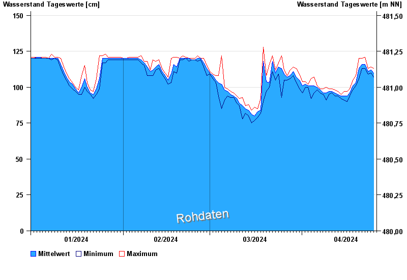
Jahresgrafik Trostberg / Alzkanal
Wasserstand vom 01.01.2024 bis zum 25.04.2024
- 00.00.0000 Wasserstand: cm
- 00.00.0000 Wasserstand: cm
- 00.00.0000 Wasserstand: cm
- 00.00.0000 Wasserstand: cm
- 00.00.0000 Wasserstand: cm
| Datum | Mittelwert [cm] | Maximum [cm] | Minimum [cm] |
|---|---|---|---|
| 25.04.2024 | 111 | 113 | 107 |
| 24.04.2024 | 112 | 114 | 110 |
| 23.04.2024 | 111 | 113 | 109 |
| 22.04.2024 | 116 | 121 | 113 |
| 21.04.2024 | 116 | 120 | 113 |
| 20.04.2024 | 113 | 120 | 106 |
| 19.04.2024 | 103 | 108 | 101 |
© Bayerisches Landesamt für Umwelt 2024