
- Startseite >
- Flüsse >
- Wasserstand >
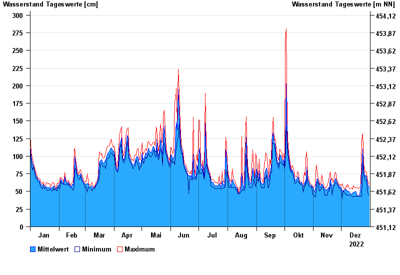
- Inn >
- Staufeneck >
- Jahresgrafik

Jahresgrafik Staufeneck / Saalach
Wasserstand vom 01.01.2022 bis zum 31.12.2022
- 14.09.1899 Wasserstand: 551 cm
- 05.07.1918 Wasserstand: 494 cm
- 07.09.1920 Wasserstand: 489 cm
- 07.08.1905 Wasserstand: 486 cm
- 31.07.1924 Wasserstand: 481 cm
| Datum | Mittelwert [cm] | Maximum [cm] | Minimum [cm] |
|---|---|---|---|
| 31.12.2022 | 56 | 60 | 45 |
| 30.12.2022 | 58 | 63 | 46 |
| 29.12.2022 | 63 | 68 | 51 |
| 28.12.2022 | 70 | 77 | 64 |
| 27.12.2022 | 73 | 79 | 66 |
| 26.12.2022 | 71 | 77 | 66 |
| 25.12.2022 | 80 | 90 | 75 |
© Bayerisches Landesamt für Umwelt 2024