
- Startseite >
- Flüsse >
- Wasserstand >
- Inn >
- Staufeneck >
- Jahresgrafik

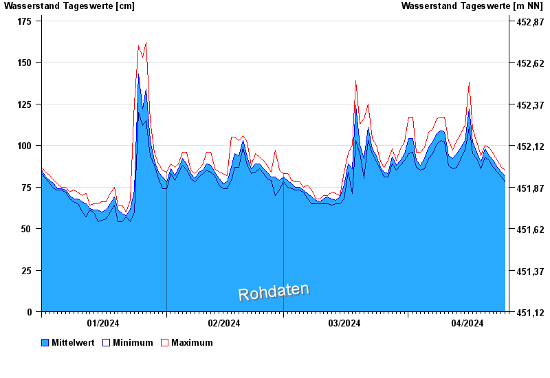
Jahresgrafik Staufeneck / Saalach
Wasserstand vom 01.01.2024 bis zum 25.04.2024
- 14.09.1899 Wasserstand: 551 cm
- 05.07.1918 Wasserstand: 494 cm
- 07.09.1920 Wasserstand: 489 cm
- 07.08.1905 Wasserstand: 486 cm
- 31.07.1924 Wasserstand: 481 cm
| Datum | Mittelwert [cm] | Maximum [cm] | Minimum [cm] |
|---|---|---|---|
| 25.04.2024 | 84 | 85 | 83 |
| 24.04.2024 | 84 | 87 | 81 |
| 23.04.2024 | 87 | 91 | 84 |
| 22.04.2024 | 91 | 95 | 87 |
| 21.04.2024 | 94 | 99 | 91 |
| 20.04.2024 | 98 | 100 | 93 |
| 19.04.2024 | 90 | 94 | 86 |
© Bayerisches Landesamt für Umwelt 2024