
- Startseite >
- Flüsse >
- Wasserstand >
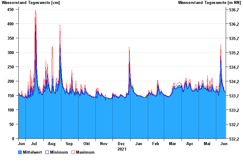
- Inn >
- Staudach >
- Jahresgrafik

Jahresgrafik Staudach / Tiroler Achen
Wasserstand vom 18.06.2021 bis zum 17.06.2022
- 02.06.2013 Wasserstand: 675 cm
- 12.08.2002 Wasserstand: 577 cm
- 03.06.2010 Wasserstand: 571 cm
- 23.12.1991 Wasserstand: 564 cm
- 03.08.1991 Wasserstand: 532 cm
| Datum | Mittelwert [cm] | Maximum [cm] | Minimum [cm] |
|---|---|---|---|
| 17.06.2022 | 163 | 167 | 160 |
| 16.06.2022 | 165 | 168 | 164 |
| 15.06.2022 | 168 | 170 | 165 |
| 14.06.2022 | 174 | 181 | 170 |
| 13.06.2022 | 181 | 184 | 178 |
| 12.06.2022 | 186 | 190 | 180 |
| 11.06.2022 | 200 | 211 | 190 |
© Bayerisches Landesamt für Umwelt 2024