
- Startseite >
- Flüsse >
- Wasserstand >
- Inn >
- Staudach >
- Jahresgrafik

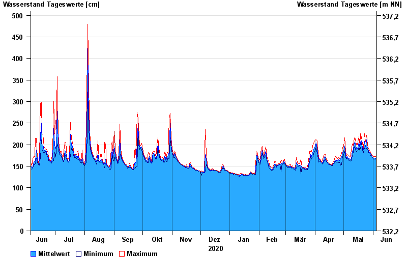
Jahresgrafik Staudach / Tiroler Achen
Wasserstand vom 05.06.2020 bis zum 04.06.2021
- 02.06.2013 Wasserstand: 675 cm
- 12.08.2002 Wasserstand: 577 cm
- 03.06.2010 Wasserstand: 571 cm
- 23.12.1991 Wasserstand: 564 cm
- 03.08.1991 Wasserstand: 532 cm
| Datum | Mittelwert [cm] | Maximum [cm] | Minimum [cm] |
|---|---|---|---|
| 04.06.2021 | 168 | 172 | 166 |
| 03.06.2021 | 169 | 173 | 166 |
| 02.06.2021 | 169 | 173 | 167 |
| 01.06.2021 | 170 | 174 | 167 |
| 31.05.2021 | 173 | 176 | 171 |
| 30.05.2021 | 176 | 180 | 173 |
| 29.05.2021 | 181 | 185 | 178 |
© Bayerisches Landesamt für Umwelt 2024