
- Startseite >
- Flüsse >
- Wasserstand >
- Inn >
- Eschelbach >
- Gesamtzeitraum

Gesamtzeitraum Eschelbach / Inn
Wasserstand vom 01.11.1969 bis zum 19.04.2024
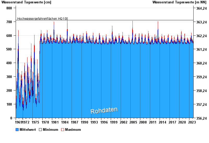
- Hochwassergefahrenfläche HQ100 710 cm
| Datum | Mittelwert [cm] | Maximum [cm] | Minimum [cm] |
|---|---|---|---|
| 19.04.2024 | 546 | 550 | 544 |
| 18.04.2024 | 551 | 554 | 549 |
| 17.04.2024 | 556 | 560 | 550 |
| 16.04.2024 | 557 | 562 | 553 |
| 15.04.2024 | 554 | 559 | 545 |
| 14.04.2024 | 547 | 551 | 544 |
| 13.04.2024 | 548 | 551 | 544 |
 weitere Messwerte weitere Messwerte | |||

© Bayerisches Landesamt für Umwelt 2024