
- Startseite >
- Flüsse >
- Wasserstand >
- Iller - Lech - Bodensee >
- Oberaudorf >
- Gesamtzeitraum

Gesamtzeitraum Oberaudorf / Inn
Wasserstand vom 01.11.1981 bis zum 25.04.2024
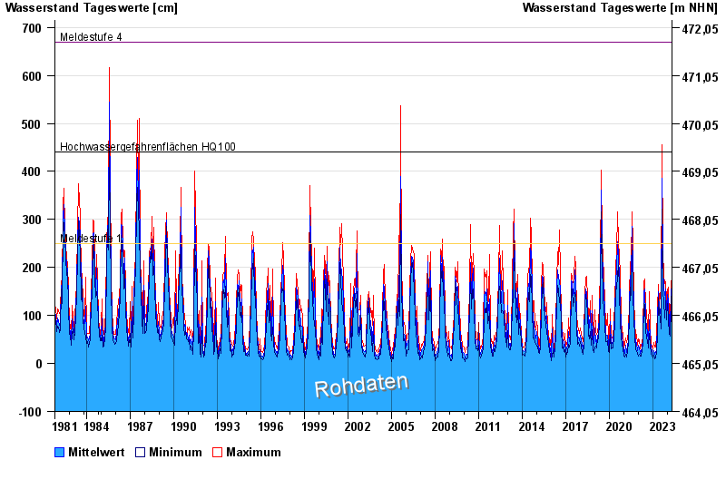
- Meldestufe 1 250 cm
- Meldestufe 4 670 cm
- Hochwassergefahrenfläche HQ100 440 cm
| Datum | Mittelwert [cm] | Maximum [cm] | Minimum [cm] |
|---|---|---|---|
| 25.04.2024 | 62 | 71 | 56 |
| 24.04.2024 | 67 | 80 | 53 |
| 23.04.2024 | 75 | 89 | 67 |
| 22.04.2024 | 72 | 82 | 60 |
| 21.04.2024 | 72 | 90 | 60 |
| 20.04.2024 | 89 | 101 | 78 |
| 19.04.2024 | 101 | 127 | 83 |
© Bayerisches Landesamt für Umwelt 2024