
- Startseite >
- Flüsse >
- Wasserstand >
- Bayern >
- Trausnitz u. d. Mühle >
- Jahresgrafik

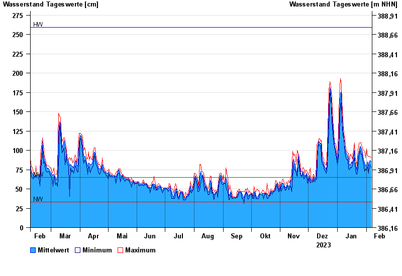
Jahresgrafik Trausnitz u. d. Mühle / Pfreimd
Wasserstand vom 07.02.2023 bis zum 06.02.2024
| Datum | Mittelwert [cm] | Maximum [cm] | Minimum [cm] |
|---|---|---|---|
| 06.02.2024 | 86 | 90 | 77 |
| 05.02.2024 | 87 | 92 | 81 |
| 04.02.2024 | 84 | 92 | 80 |
| 03.02.2024 | 80 | 91 | 70 |
| 02.02.2024 | 86 | 93 | 80 |
| 01.02.2024 | 81 | 102 | 74 |
| 31.01.2024 | 80 | 90 | 76 |
© Bayerisches Landesamt für Umwelt 2024