
- Startseite >
- Flüsse >
- Wasserstand >
- Bayern >
- Seltmans >
- Jahresgrafik

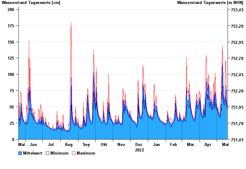
Jahresgrafik Seltmans / Untere Argen
Wasserstand vom 20.05.2022 bis zum 19.05.2023
 Für diesen Pegel sind keine Hochwassermarken hinterlegt.
| Datum | Mittelwert [cm] | Maximum [cm] | Minimum [cm] |
|---|---|---|---|
| 19.05.2023 | 49 | 52 | 46 |
| 18.05.2023 | 57 | 64 | 52 |
| 17.05.2023 | 83 | 119 | 64 |
| 16.05.2023 | 66 | 121 | 55 |
| 15.05.2023 | 65 | 84 | 53 |
| 14.05.2023 | 55 | 58 | 52 |
| 13.05.2023 | 58 | 62 | 55 |
© Bayerisches Landesamt für Umwelt 2024