
- Startseite >
- Flüsse >
- Wasserstand >
- Bayern >
- Puppling >
- Jahresgrafik

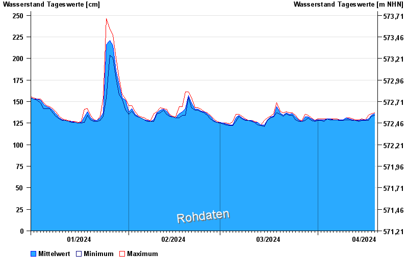
Jahresgrafik Puppling / Isar
Wasserstand vom 01.01.2024 bis zum 19.04.2024
- 400 cm: Ascholding: Überflutung Sägewerk Harrer.
- 450 cm: Ascholding: Überflutung der Flur von Kalkofen bis Ascholding.
- 550 cm: Weidach: Überflutungen des Vorlandes.
| Datum | Mittelwert [cm] | Maximum [cm] | Minimum [cm] |
|---|---|---|---|
| 19.04.2024 | 136 | 137 | 134 |
| 18.04.2024 | 134 | 136 | 133 |
| 17.04.2024 | 130 | 134 | 128 |
| 16.04.2024 | 129 | 129 | 128 |
| 15.04.2024 | 129 | 130 | 128 |
| 14.04.2024 | 128 | 129 | 127 |
| 13.04.2024 | 128 | 129 | 128 |
© Bayerisches Landesamt für Umwelt 2024