
- Startseite >
- Flüsse >
- Wasserstand >
- Bayern >
- Mittenwald >
- Jahresgrafik

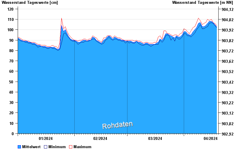
Jahresgrafik Mittenwald / Isar
Wasserstand vom 01.01.2024 bis zum 19.04.2024
- 280 cm: Mittenwald: Beginn der Ausuferung im Ort oberhalb der Karwendelbrücke links.
- 300 cm: Mittenwald: Überflutung landwirtschaftlicher Flächen
| Datum | Mittelwert [cm] | Maximum [cm] | Minimum [cm] |
|---|---|---|---|
| 19.04.2024 | 103 | 104 | 102 |
| 18.04.2024 | 105 | 106 | 104 |
| 17.04.2024 | 107 | 107 | 106 |
| 16.04.2024 | 108 | 110 | 107 |
| 15.04.2024 | 108 | 109 | 106 |
| 14.04.2024 | 106 | 110 | 103 |
| 13.04.2024 | 104 | 107 | 102 |
© Bayerisches Landesamt für Umwelt 2024