
- Startseite >
- Flüsse >
- Wasserstand >
- Bayern >
- Bayreuth >
- Jahresgrafik

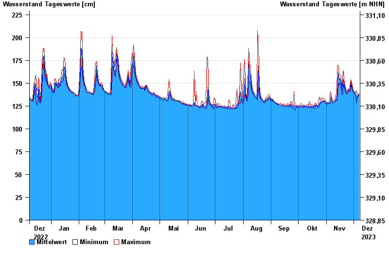
Jahresgrafik Bayreuth / Roter Main
Wasserstand vom 08.12.2022 bis zum 07.12.2023
- 26.01.1995 Wasserstand: 295 cm
- 06.06.1984 Wasserstand: 288 cm
- 15.06.1987 Wasserstand: 276 cm
- 21.12.1993 Wasserstand: 274 cm
- 13.01.2011 Wasserstand: 273 cm
| Datum | Mittelwert [cm] | Maximum [cm] | Minimum [cm] |
|---|---|---|---|
| 07.12.2023 | 138 | 138 | 137 |
| 06.12.2023 | 136 | 138 | 135 |
| 05.12.2023 | 136 | 137 | 135 |
| 04.12.2023 | 136 | 142 | 128 |
| 03.12.2023 | 137 | 139 | 136 |
| 02.12.2023 | 140 | 141 | 138 |
| 01.12.2023 | 141 | 142 | 140 |
© Bayerisches Landesamt für Umwelt 2024