
- Startseite >
- Flüsse >
- Wasserstand >
- Bayern >
- Anger >
- Jahresgrafik

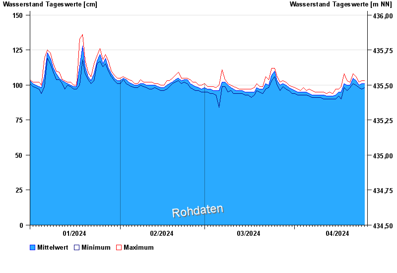
Jahresgrafik Anger / Attel
Wasserstand vom 01.01.2024 bis zum 25.04.2024
- 02.08.1991 Wasserstand: 293 cm
- 05.08.2020 Wasserstand: 262 cm
- 03.06.2013 Wasserstand: 262 cm
- 18.06.1979 Wasserstand: 258 cm
- 22.05.1999 Wasserstand: 252 cm
| Datum | Mittelwert [cm] | Maximum [cm] | Minimum [cm] |
|---|---|---|---|
| 25.04.2024 | 101 | 103 | 99 |
| 24.04.2024 | 101 | 103 | 97 |
| 23.04.2024 | 100 | 102 | 98 |
| 22.04.2024 | 103 | 106 | 100 |
| 21.04.2024 | 105 | 108 | 101 |
| 20.04.2024 | 100 | 102 | 98 |
| 19.04.2024 | 100 | 103 | 96 |
© Bayerisches Landesamt für Umwelt 2024